
 5 min readIreland's best beaches, province by provinceTwenty beaches worth the drive, sorted by province, with what each one is actually like when you get there.
Guide
The Wild Atlantic Way from Clare to Donegal
The Wild Atlantic Way is the signed route down the west coast of Ireland, and the stretch from Clare to Donegal is the half most people mean when they talk about it. Give it a week. This is what we would stop for in each county, and what we would drive past.
Where the coast road actually starts
The signed route runs the whole west coast, and people argue about where the good part begins. We would start it in Clare. South of that you are in Kerry and west Cork, which are worth a week of their own and are covered on their own county pages. North of Clare the road stops being a scenic drive and starts being the only road, which is when it gets good.
Give it a week if you can. Five days works. Three days is Clare, Galway and a lot of driving, and you will spend the last one wishing you had cut something.
Clare, and the quieter end of the cliffs
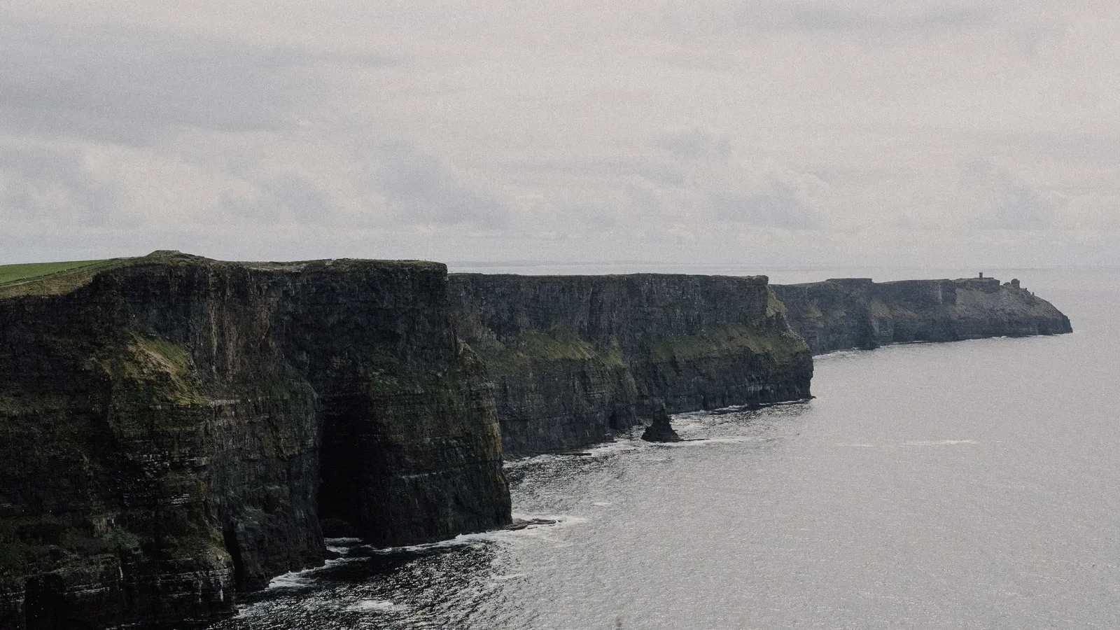
The Cliffs of Moher run about 14km down the coast and the visitor centre is dug into the hillside above Liscannor, so the building never gets in the way of the view. Most people see the same 400 metres of path either side of it. Walk further than the crowd does and you will have it to yourself inside twenty minutes.
The other end of the county is where we would put the second day. Loop Head has a working lighthouse with the tower open to climb, and the cliffs west of Kilkee have a signed path that starts in the town itself. Inland from all of it the Burren is bare limestone with a five thousand year old tomb sitting on top of it at Poulnabrone, beside the road, no ticket.
Galway, then almost nobody
Galway city is the last place on this route where you will queue for anything. Give it a night, walk the Latin Quarter lanes and the prom out at Salthill, then get out of it.
Connemara behind the city is the emptiest good country in Ireland. Killary is a long narrow sea inlet with mountain on both sides and the road running along the water. Kylemore sits on a lake below the hills. Diamond Hill inside Connemara National Park is a looped path from Letterfrack and you can be up and down in a morning.
The ferry from Rossaveal takes you out to Inis Mor, where Dun Aonghasa sits on the edge of a sea cliff with nothing between you and the drop. It is the one stop on this list that people talk about for years afterwards.
Mayo, which is the best day on the route
If you only have one full day to spend on the Wild Atlantic Way, spend it in Mayo.
Keem Bay is a horseshoe of beach at the west end of Achill, and the cliff road down to it out of Keel is the drive. Croagh Patrick stands over Clew Bay and the climb from Murrisk goes up to a chapel on the 764 metre summit, which is a hard three hours and worth every one of them. If you would rather not climb anything, the Great Western Greenway is about 42km of traffic free path on the old Westport to Achill railway line.
North Mayo is the part people miss. Downpatrick Head is a grass topped headland with the Dun Briste sea stack standing just off it. Ten minutes away, the Ceide Fields are neolithic field walls that sat under blanket bog until somebody cutting turf found them, and the visitor centre is out on the cliff edge above them.
Sligo, and a mountain you can see from everywhere
Benbulben is flat on top and it follows you around the county. There is a looped forest trail around the base of it, and under it at Drumcliffe an early monastic site with a carved high cross beside the churchyard W B Yeats is buried in.
Strandhill is the surf beach, west of the town, with a promenade behind it. The currents in the water there are strong and it is not a paddling beach. Mullaghmore Head up the coast has a small harbour and a big wave break offshore, and Streedagh beach beside it is where three Armada ships went down in 1588.
Donegal, the part people run out of time for
Almost everyone gets to Sligo and turns for home. Donegal is bigger than Sligo and Leitrim put together and it holds the best of the route.
Sliabh Liag has sea cliffs on the southwest coast with a road up to the car park and a walking path along the ridge. Glencolmcille below it has a row of rebuilt thatched cottages on a hillside above the beach, each one furnished to a different century. Further north, Ards Forest Park sits on a peninsula in Sheephaven Bay with dunes and small beaches inside it, and Fanad Head has a working lighthouse at the mouth of Lough Swilly that takes visitors into the old keepers' houses.
Malin Head is the end of it and the most northerly point of the mainland, with a signal tower, a car park and a cliff path down to Hell's Hole. Stand there for ten minutes and the week makes sense.
What we would leave out
Every second village on this coast has a sign pointing at a viewpoint. Most of them are a lay by with a gap in a hedge. Pick four or five real stops a day and drive past the rest, because the alternative is eight hours of getting in and out of a car.
We would also skip doing the whole signed route end to end in one go unless you have a fortnight. The road is long, a lot of it is the same low bog and small field, and the good parts are clustered. Clare, Connemara, Achill, north Mayo and southwest Donegal are the clusters. Drive between them and stop properly when you get there.
More guides
5 min readIreland's best beaches, province by provinceTwenty beaches worth the drive, sorted by province, with what each one is actually like when you get there. 5 min readA first-timer's week in IrelandSeven days that take in Dublin, the Boyne valley, the southwest and the Burren without spending the whole week in the car.
 5 min readIreland in the rain: what to do when the weather turnsIt rains on about half the days of the year, so here are the places that are better in it, county by county, plus the outdoor ones that do not care.